 |
 |
 |
 |
 |
 |
 |
 |
|
Richland County, Ohio USGenWeb Site |
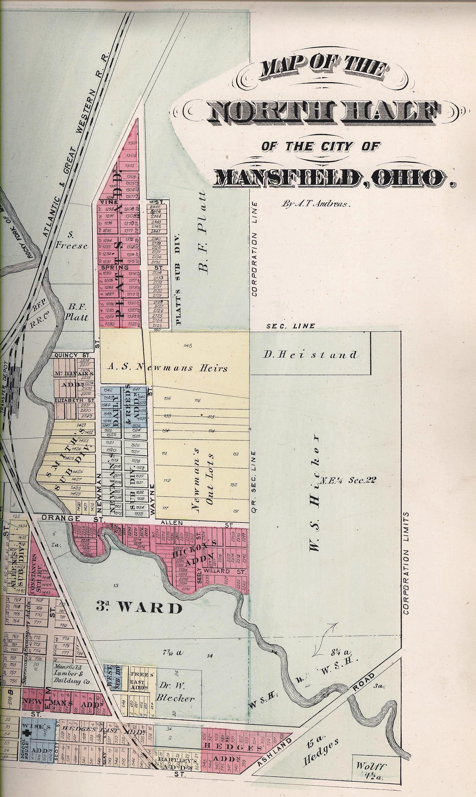
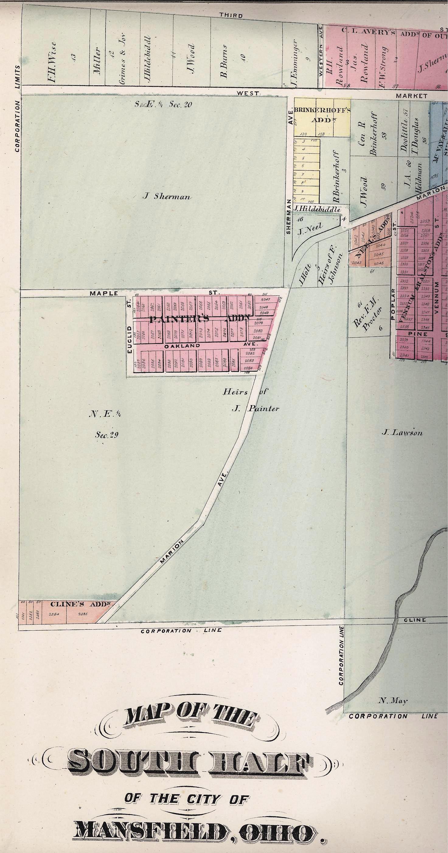
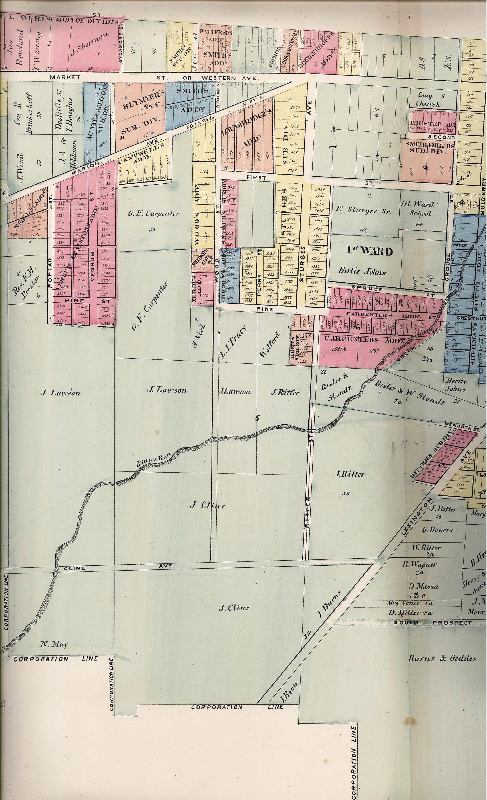
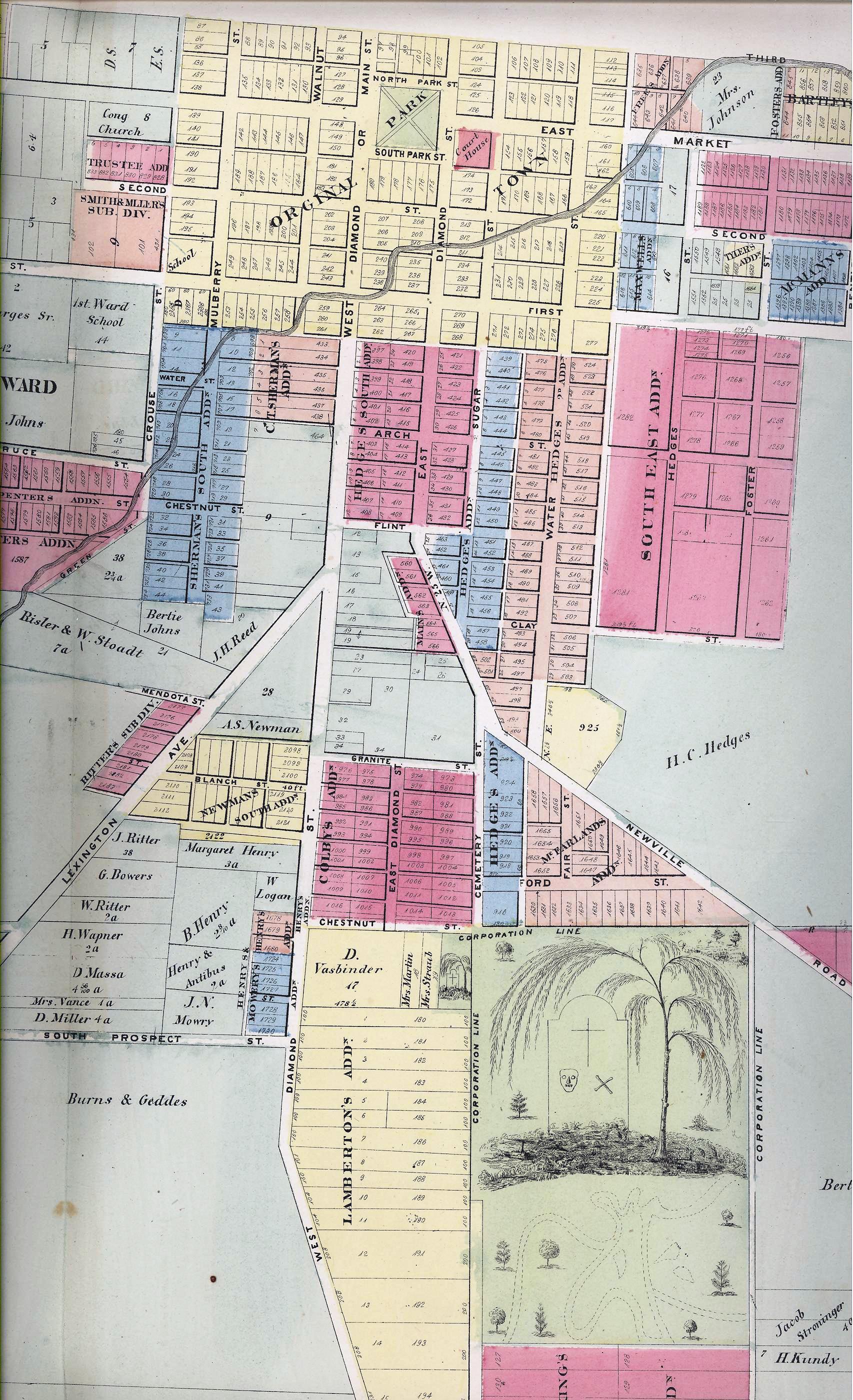
Plat Book, 1873 |
Mansfield
in Madison Twp.
Source: ATLAS MAP OF RICHLAND COUNTY, OHIO. Compiled, Drawn & Published from Personal Graminations & Surveys by A.T. Andreas. Chicago, Ill., 1873, p. 52-54
Select Other Township Maps | Legend of Symbols Used
Click on icon to view map at actual size
|
|
|
|
|
|
|
|
|
|
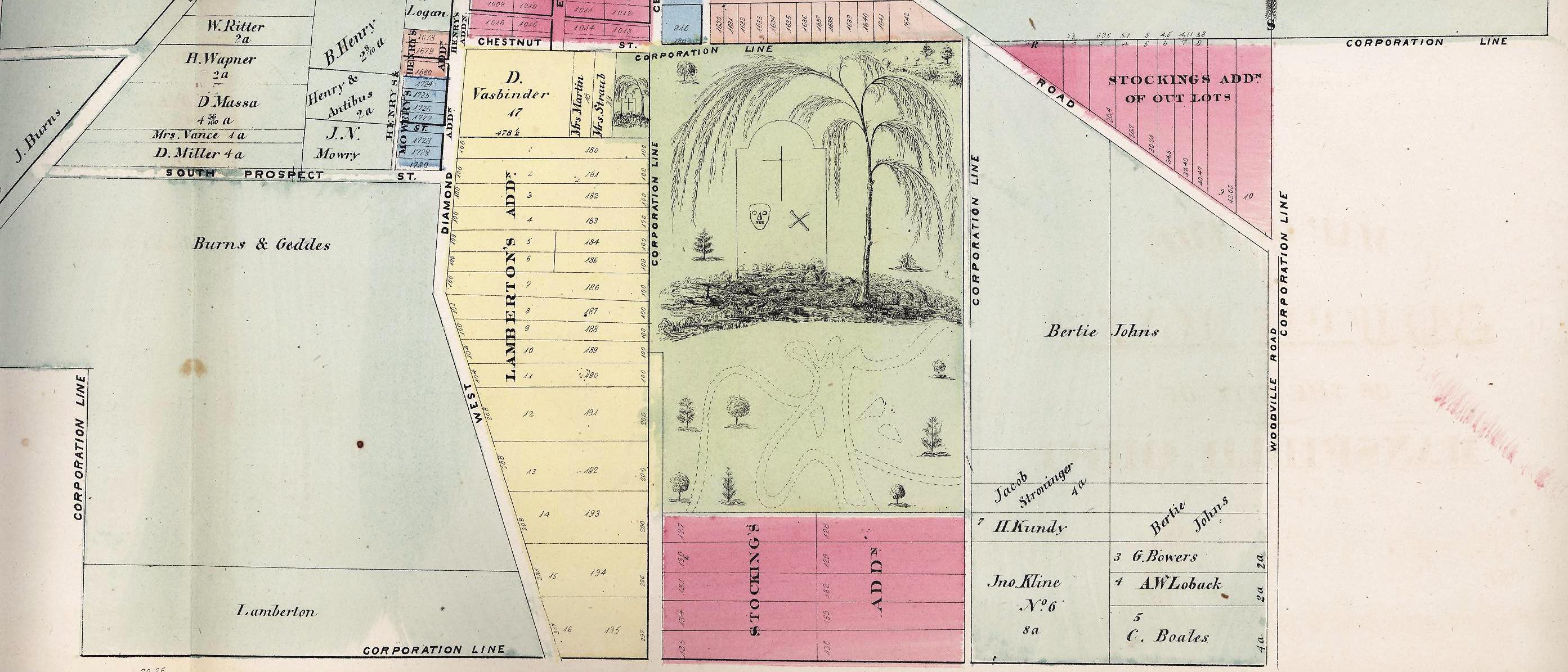
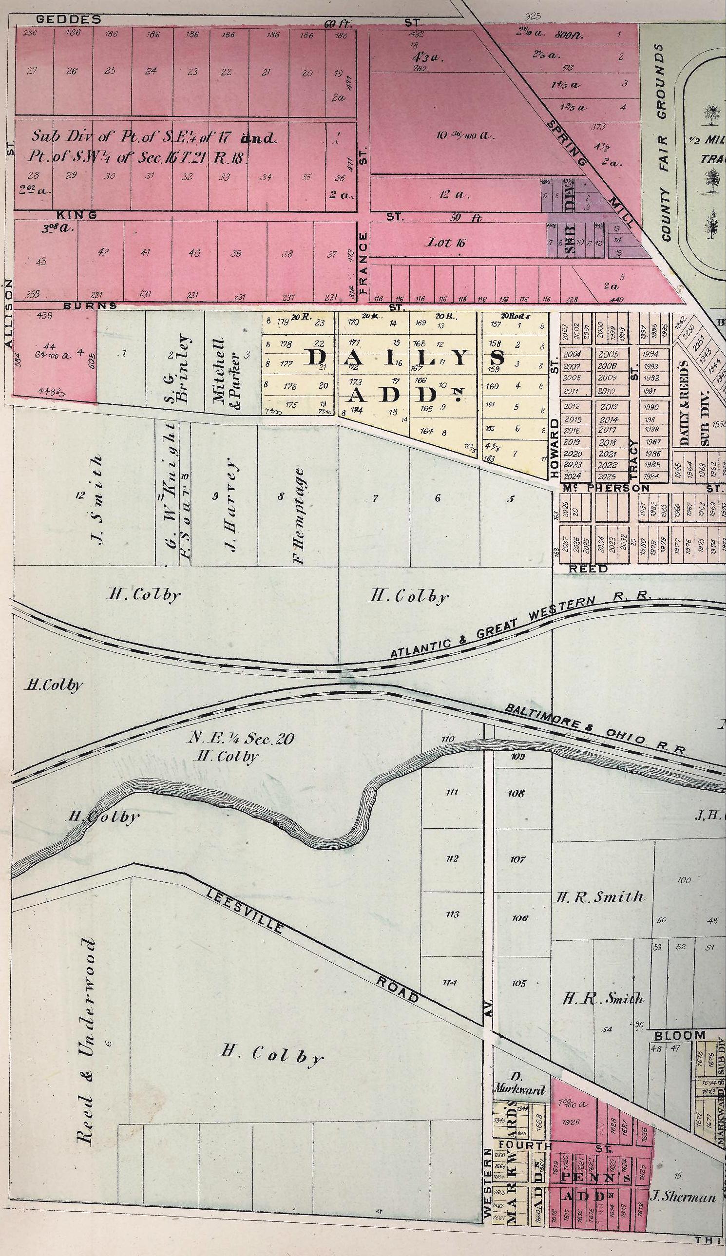
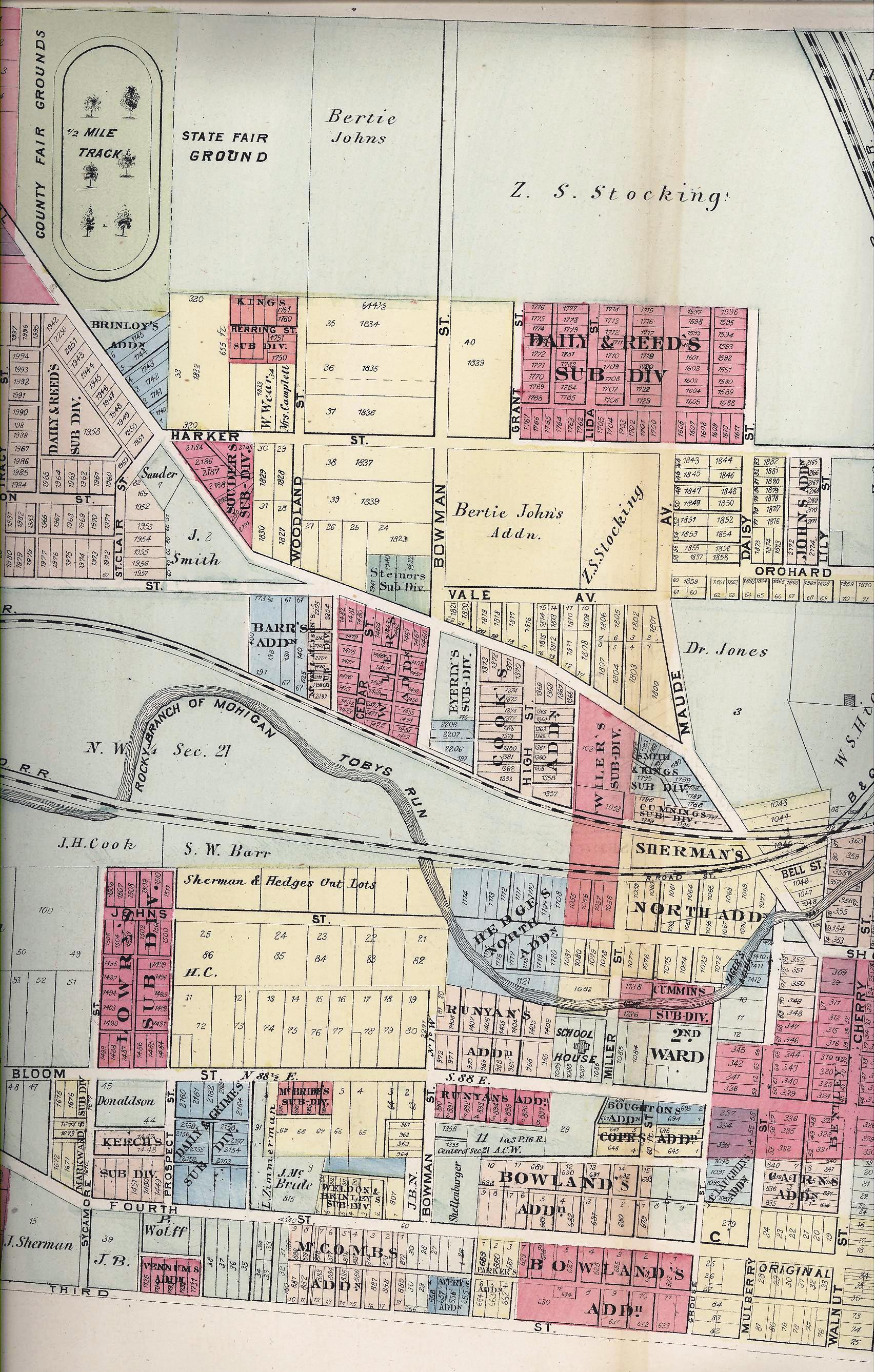
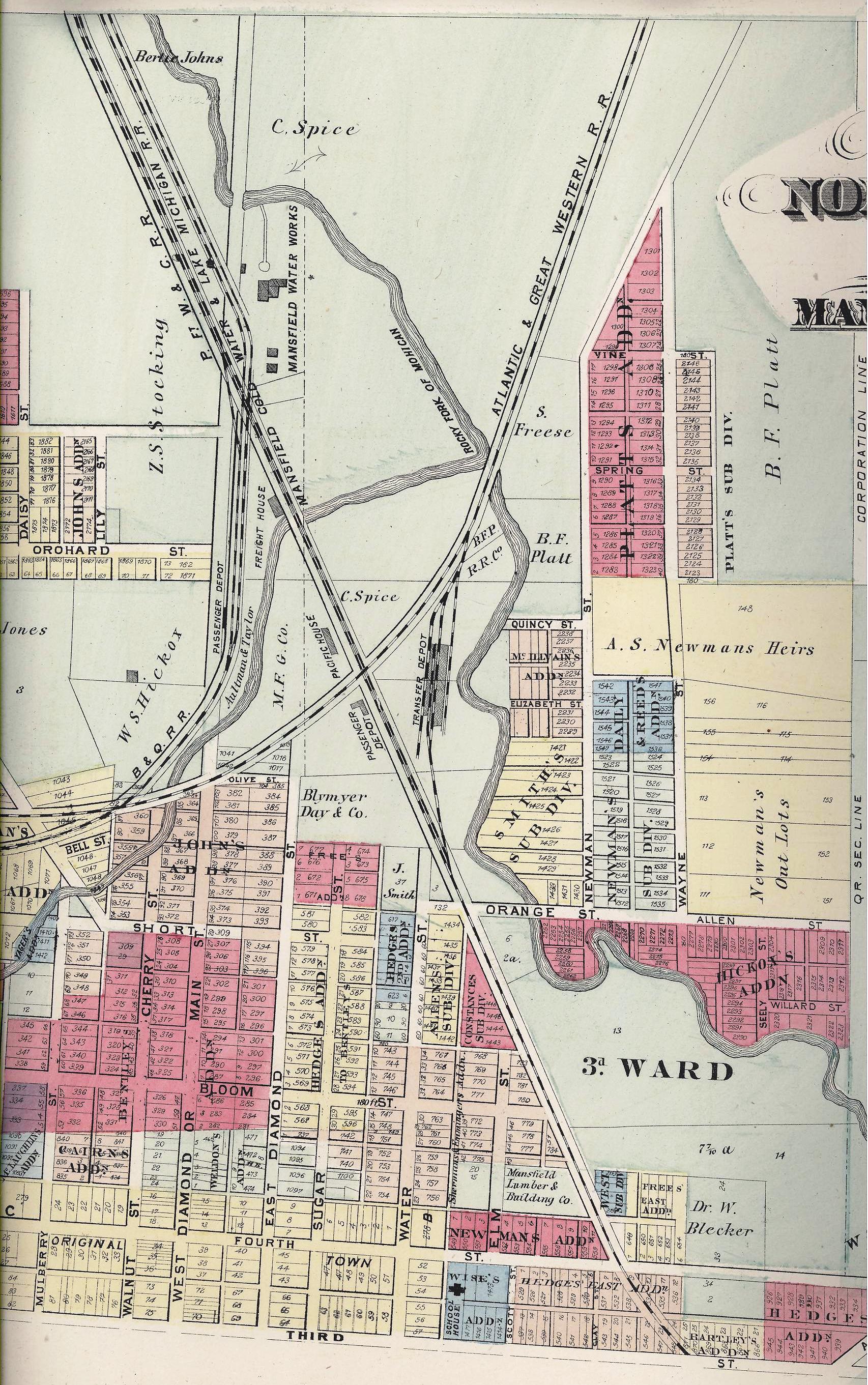
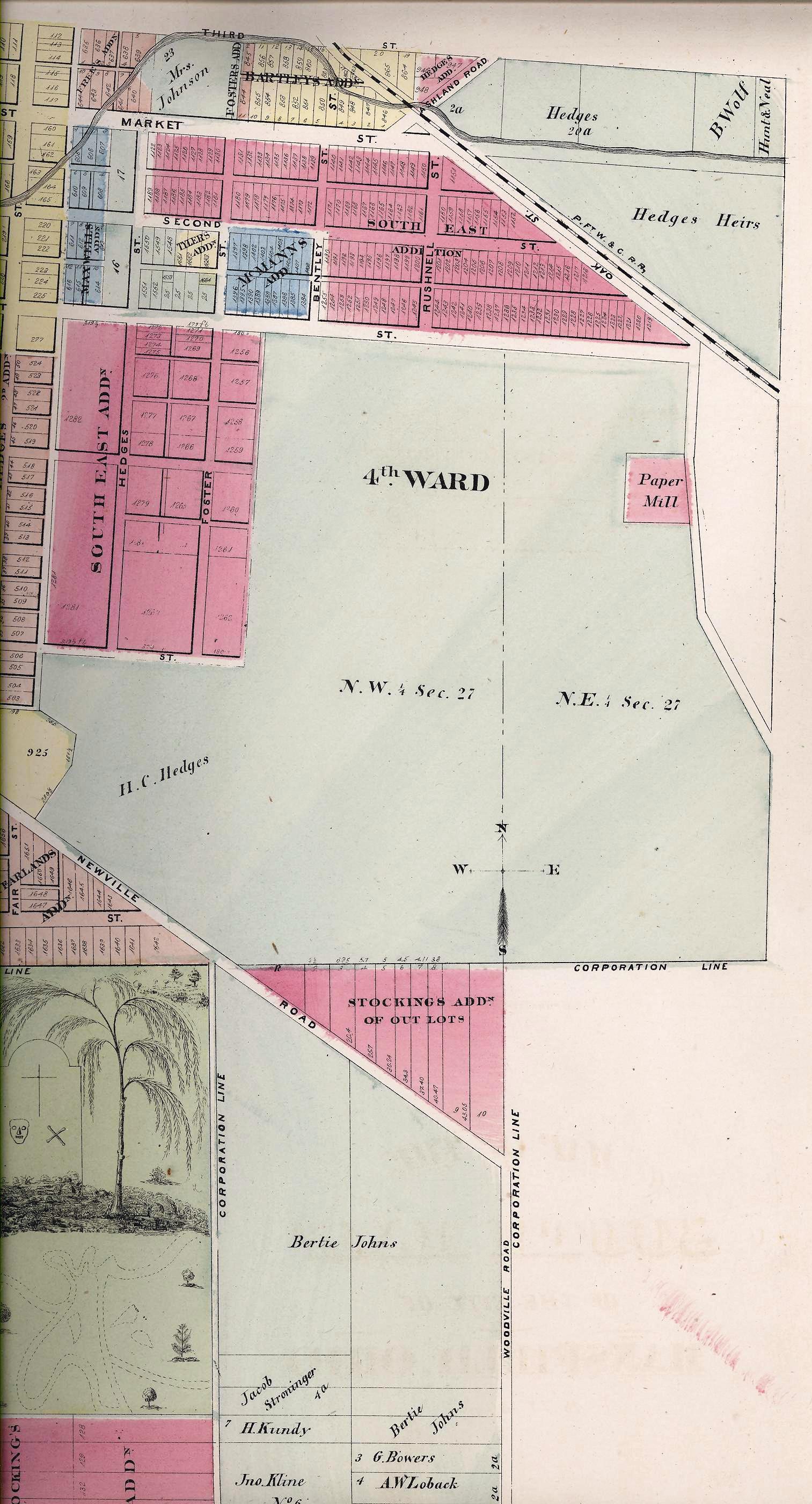
Section just south of Mansfield Cemetery
MOST of the lots on the Mansfield maps are not identified. There are a few larger lots and section names that are listed on the maps.
Surnames mentioned: SMITH, BRINLEY, PARKER, MITCHELL, KNIGHT, SOURS, HEMPTAGE, UNDERWOOD, COLBY, BARR, COOK, JOHNS, STOCKING, JONES, HICKOX, SPICE, FREESE, PLATT, HEISTAND, HEDGES, WOLFF, BLYMYER, SHERMAN, REED, ZIMMERMAN, PAINTER, LAWSON, PROCTOR, CARPENTER, LAWSON, CLINE, BURNS, RITTER, RIESTER, STOODT, BOWERS, WAPNER, MASSA, VANCE, MILLER, GEDDES, BURNS, LAMBERTON, REED, JOHNS, HEDGES, KUNDY, KLINE, BOWERS, LOBACK, BOALES, HEDGES, JOHNSON, WOOD, HILDEBRANDT, GRIMES, WISE
Additions: Daily, Penn, Markward, Vennum, Keech, Grim, Lowry, McBride, Weldon, Steiner, Bowland, Boughton, Newman, Hickox, Hedges, Wise, Bartley, Painter, Cline, Avery, Blymyer, Smith, Southeast, Stockings, Lamberton, Newman South
<< Back to 1873 Plat Book Page
View other Land Records >>
<< Back to the Richland Co., Ohio Index