|
Richland Co., Ohio |
|||||||
|
Maps |
|||||||
| - | - | - | - | - | - | ||
|
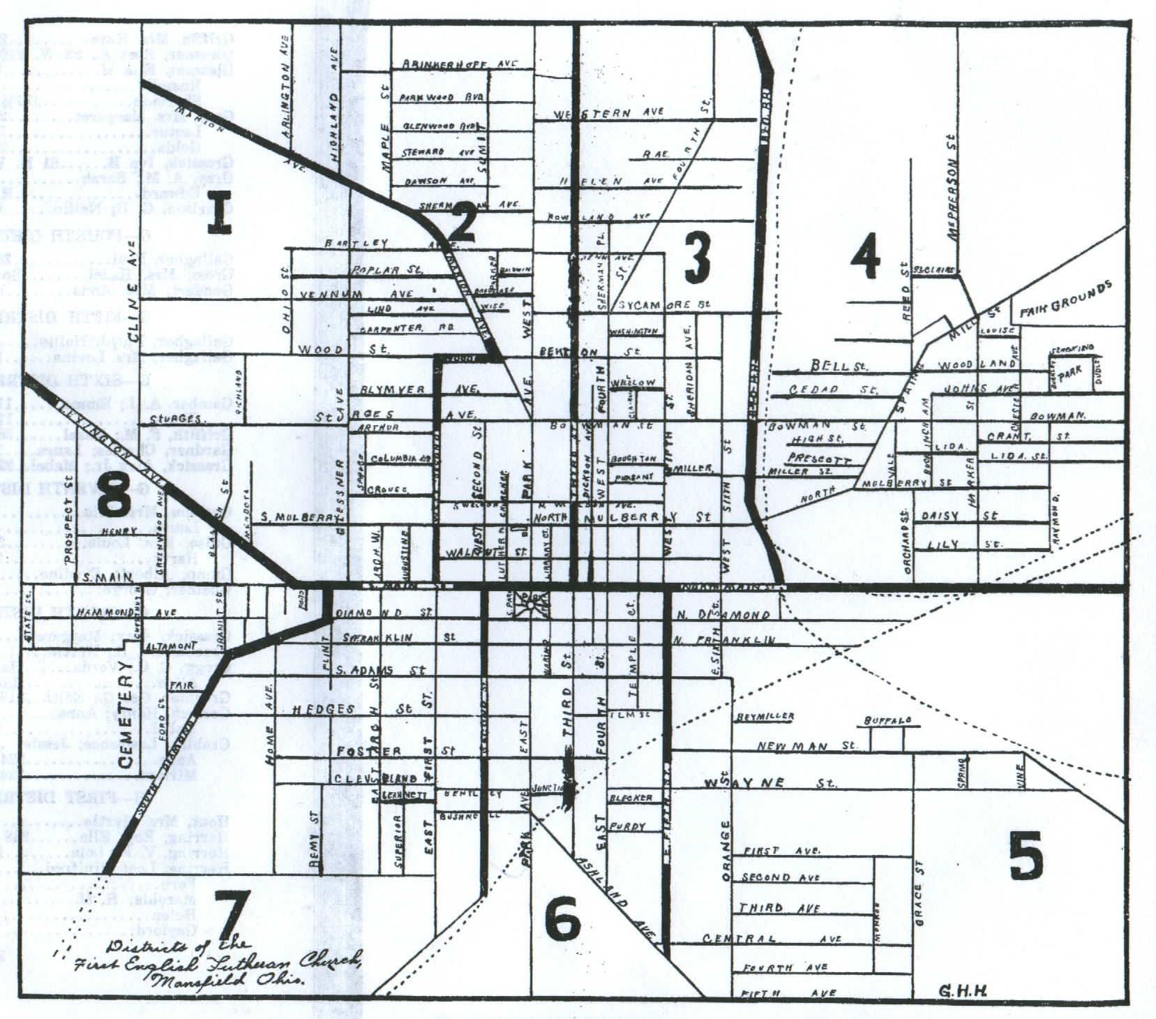
Mansfield Map, 1918 |
|||||||
| --- | |||||||
|
|
|||||||
|
Source: OFFICIAL REPORT OF THE MEMBERSHIP AND FINANCES OF THE FIRST ENGLISH EVANGELICAL LUTHERAN CHURCH OF MANSFIELD, OHIO For the Year Ending Sept. 30, 1918. Issued by the Act of the Church Council, April 11, 1893. |
|||||||
|
|
|||||||
|
Submitted by Peggy |
|||||||
|
|
|||||||
|
Please note that this map is turned so that it gives an odd impression of the city. To get a good understanding of what is north, south, east and west - the page should be turned 90° to the left, so that the cemetery is positioned at the southern edge or bottom of the page. The large numbers on the map simply refer to districts used by the First English Evangelical Lutheran Church at the time. |
|||||||
<< Back to Maps Index
<< Back to the Richland Co., Ohio Index